
This is a shortened version of my catalog it has been created as a companion to the
Art and Science on the Katmai Coast traveling exhibit. If you would like to purchase a full version of the magazine either in print or electronic form you can purchase it by clicking the highlighted text.
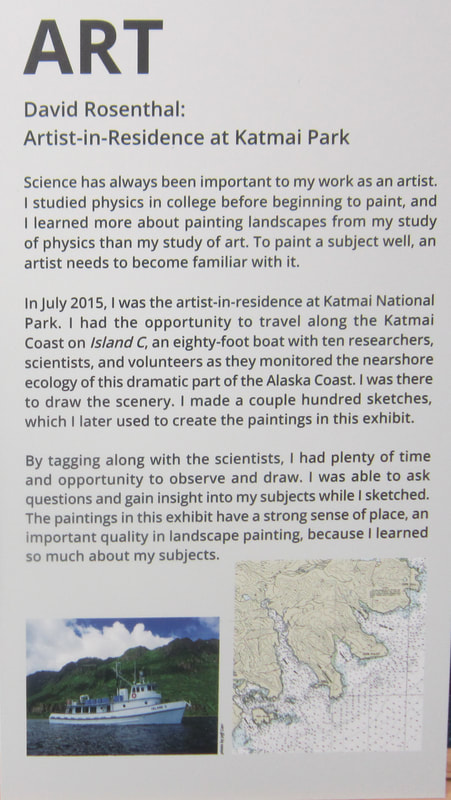
Science has always been important to my work as an artist. I studied physics in college before beginning to paint, and learned more about painting landscapes from my study of physics than my study of art. To paint a subject well, and artist needs to become familiar with it.
In July 2015, I was artist-in-residence at Katmai National Park. I had the opportunity to travel along the Katmai Coast onIsland C, an eighty-foot boat with 10 researchers, scientists, and volunteers as they monitored the nearshore ecology of this dramatic part of the Alaska Coast. I was there to draw the scenery. I made a couple hundred sketches, which I later used to create the paintings in this exhibit.
Art and Science on the Katmai Coast traveling exhibit. If you would like to purchase a full version of the magazine either in print or electronic form you can purchase it by clicking the highlighted text.
Science has always been important to my work as an artist. I studied physics in college before beginning to paint, and learned more about painting landscapes from my study of physics than my study of art. To paint a subject well, and artist needs to become familiar with it.
In July 2015, I was artist-in-residence at Katmai National Park. I had the opportunity to travel along the Katmai Coast onIsland C, an eighty-foot boat with 10 researchers, scientists, and volunteers as they monitored the nearshore ecology of this dramatic part of the Alaska Coast. I was there to draw the scenery. I made a couple hundred sketches, which I later used to create the paintings in this exhibit.
SCIENCE
Long-Term Monitoring of Nearshore Marine Resources on the Coast of Katmai Park
The monitoring encompasses major elements of the nearshore trophic web, from primary producers to apex predators, and focuses on six vital signs: kelp and seagrass, marine intertidal invertebrates, marine birds, black oyster catchers, sea otters and marine water chemistry and quality. Dean, Bodkin, Coletti, Protocol Narrative NRR 2014/756
The nearshore can be defined as that section of marine ecosystem that extends from high tideline to depths of about 20 meters. It can be divided into the intertidal zone (between high-water and lower-low water) and the nearshore sub tidal zone (low water to 20 meters in depth). The intertidal shorelines are diverse and vary from sheltered marshlands and beaches to steep rocky outcroppings subjected to high waves. The sub tidal zone is a mix cobble/gravel, rocky outcroppings and sand/silt. Dean, Bodkin, Coletti, Protocol Narrative NRR 2014/756
The scientists I worked with at Katmai National Park are part of Gulf Watch Alaska, a project that provides long-term monitoring of near-shore marine resources in the Gulf of Alaska.
I spent about ten days with them. The scientists chose what they call "the six vital signs" to study, considering the relationship of each to the whole system. When they observed sea otters and Black Oyster catchers, they were not just looking at how these charismatic animals spent their time. They were documenting what they fed on, how plentiful their prey was, and other factors to monitor the overall condition of the ecosystem.
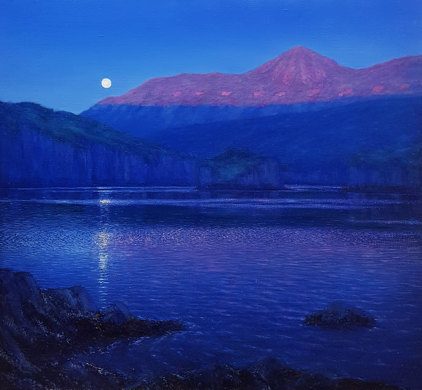
Moonrise
Oil on linen 28” x 30”
On a beautiful morning in Amalik Bay, the first rays of the sunrise can be seen illuminating the top of a ridge
with violet light, as the almost full moon sets.
Oil on linen 28” x 30”
On a beautiful morning in Amalik Bay, the first rays of the sunrise can be seen illuminating the top of a ridge
with violet light, as the almost full moon sets.
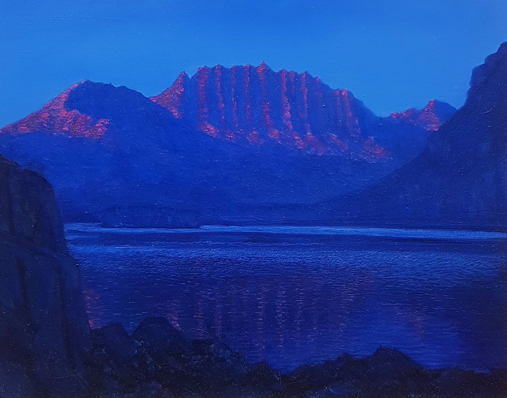
Sunrise Light on Mountains
Oil on board 16” x 20”
The tops of some craggy mountains near Geographic Bay are illuminated by early sunrise light.
Oil on board 16” x 20”
The tops of some craggy mountains near Geographic Bay are illuminated by early sunrise light.
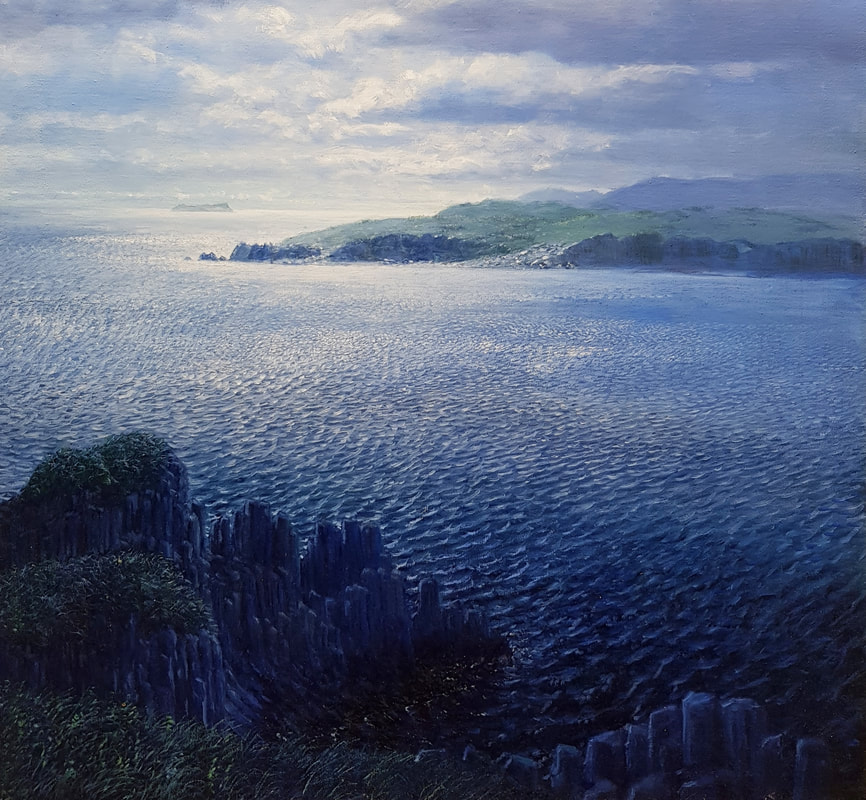
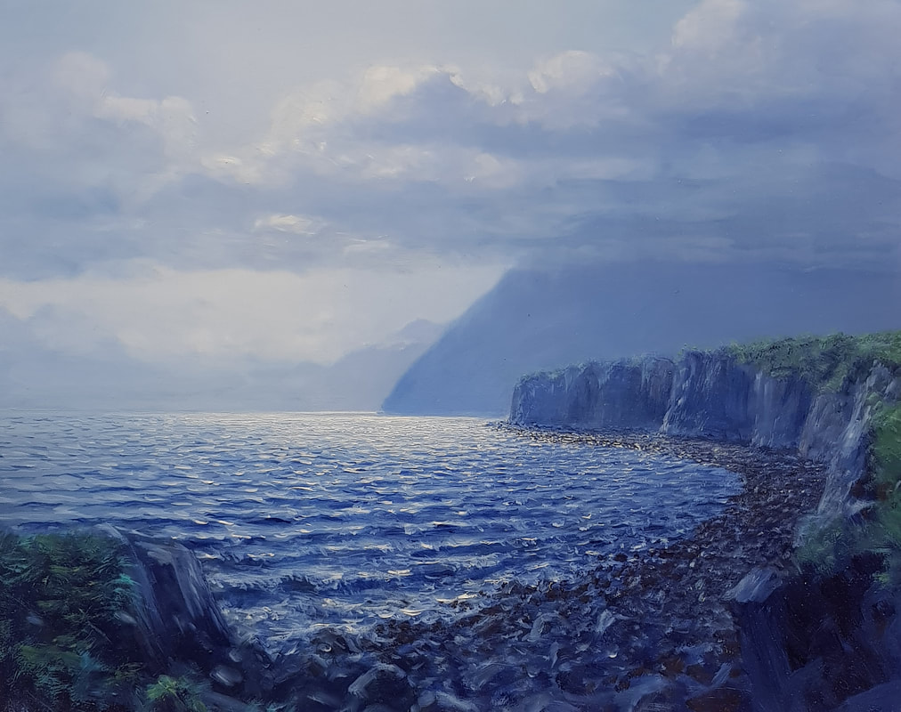
Basalt Palisades
Oil on linen 28” x 30”
On the way to the head of Geographic Bay, these huge basalt cliffs can be seen stretching off into the distance, back lit by the morning sun.
Oil on linen 28” x 30”
On the way to the head of Geographic Bay, these huge basalt cliffs can be seen stretching off into the distance, back lit by the morning sun.
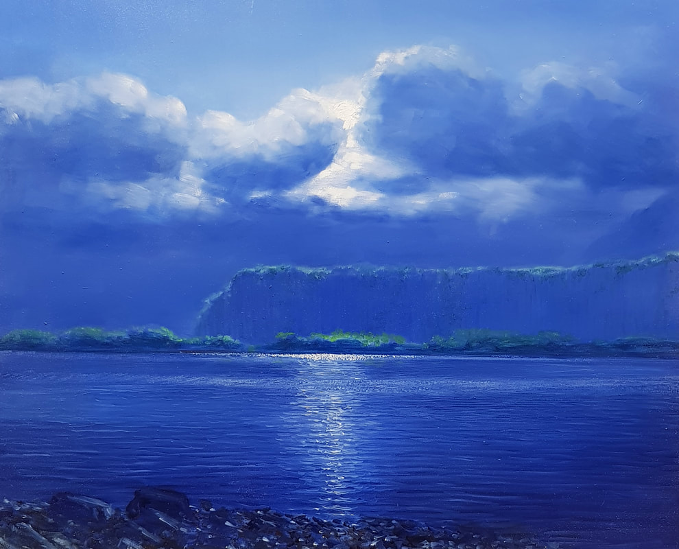
Sun in Clouds
Oil on board 16” x 20”
From Amalik Bay the basalt palisades can be seen from a distance, with the evening sun setting into gathering clouds above.
Oil on board 16” x 20”
From Amalik Bay the basalt palisades can be seen from a distance, with the evening sun setting into gathering clouds above.
Vital Sign 1: Sea Grass & Kelp
Kelp other algae and sea grasses are "living habitats" that serve as nutrient filter, provide understory and habitat for planktivorous fish, clams, urchins and a physical substrate for other
invertebrates and algae. Kelp and other algae are the major primary producers in the marine near shore, and because they are located in shallow water, they could be significantly impacted by human activities. These include spills of oil or other contaminants, dredging disturbances from anchoring vessels, and increased turbidity caused by run off sediments or nutrients. Dean, Bodkin, Coletti, Protocol Narrative NRR 2014/756
At the beginning of the project scientists chose several sites to monitor seagrass and kelp. The kelp and eelgrass beds were monitored visually both from shore and from zodiacs, and their boundaries were recorded with GPS. I did not actually participate in these surveys, but the surveys drew my attention, and I saw a lot of the different color patterns caused by the various types of algae and grasses growing at different zones along the nearshore.
Vital Sign 2: Marine Invertebrates
Marine intertidal invertebrates provide critical food resources for shorebirds, ducks, fish, bears, sea otters and other marine invertebrate predators, as well a spawning and nursery habitat for forage fish and juvenile crustaceans. Benthic invertebrates and algae are ecologically diverse in terms of habitat and trophic requirements, have wide range of physiological tolerances, are relatively sedentary, and have varied life histories. As a result they are good biological indicators of both short term (e.g. annual) and long term (e.g. decadel) changes in environmental conditions. Dean, Bodkin, Coletti, Protocol Narative NRR 2014/756
To monitor the marine intertidal kelps and invertebrates, five sites were selected back when the project began. The sites are near the kelp monitoring areas and are revisited every year. Stainless steel hooks were embedded in the rocks at these sites and every year surveyor tapes are hooked to them, creating transects at the same places. Small grids are placed along the transects at randomly assigned locations. Mussels, other invertebrates and kelps are sampled. I went along on a number of these surveys and occasionally help by recording data.
The emphasis on near shore organisms help me see how they live at different levels in the tidal zone, creating bands of color along the shore. The mussels formed a blue-black stripe below the orange and green Fucus kelp, with light brown barnacles on bare rock above, and then the dark grey black Verracella lichen at about the high tide level. These color patterns can be seen in most of my paintings in this exhibit and have been key to establishing space and scale, which gives the paintings their presence.
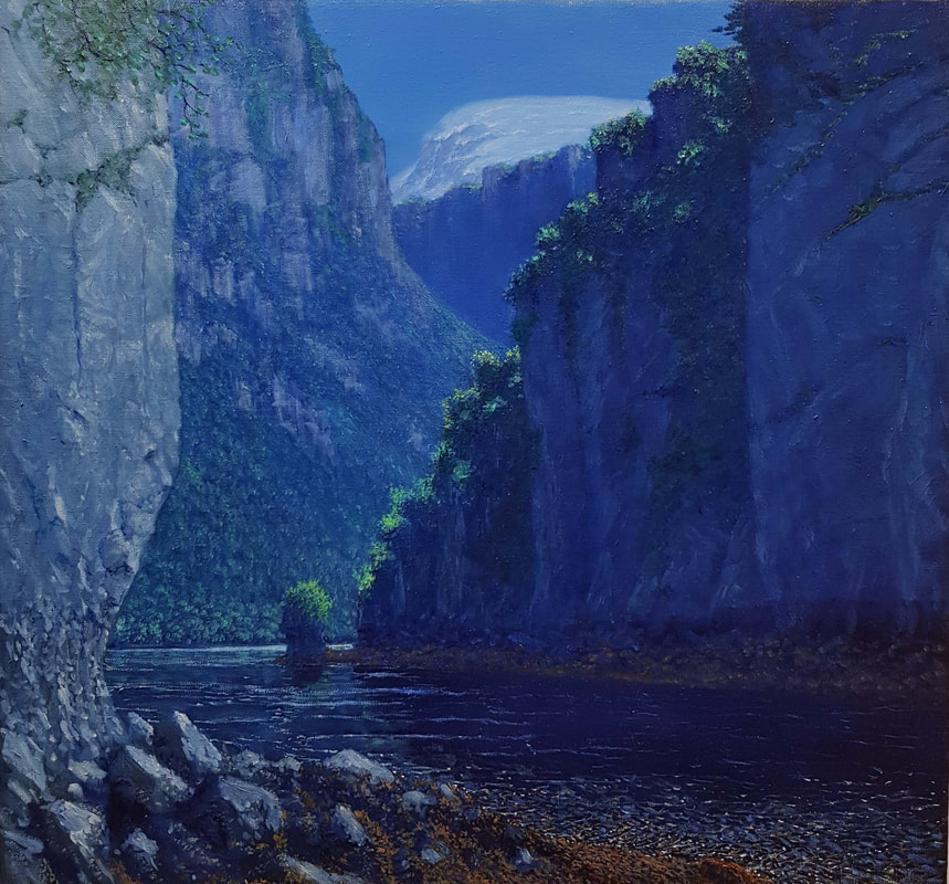
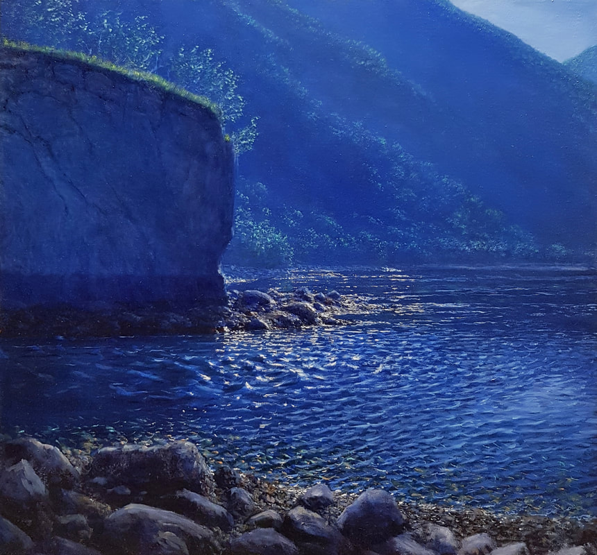
Entrance to Hidden Cove
Oil on linen 28” x 30”
A small cove is connected to the ocean by a narrow high walled cut in the basalt surrounding it. One of the large snow covered volcanoes can be seen in the distance.
Oil on linen 28” x 30”
A small cove is connected to the ocean by a narrow high walled cut in the basalt surrounding it. One of the large snow covered volcanoes can be seen in the distance.
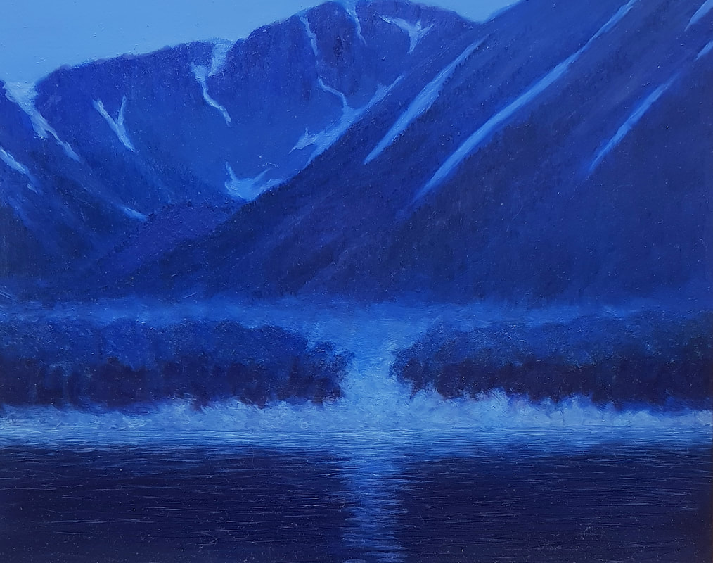
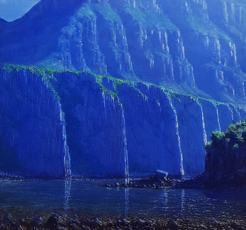
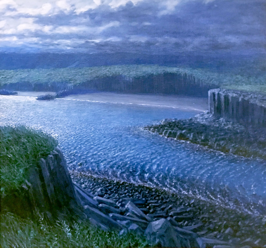
Mist Fall in Hidden Cove Oil on board 16” x 20”
Inside hidden cove, early on a blue morning, mist can be seen flowing down from the surrounding mountains and out of a small stream cut gap in a basalt cliff, pouring out onto the water.
Inside hidden cove, early on a blue morning, mist can be seen flowing down from the surrounding mountains and out of a small stream cut gap in a basalt cliff, pouring out onto the water.
Tidal Outflow from Hidden Cove Oil on linen 28” x 30”
The narrow passage out of Hidden Cove makes for a dramatic flow through the cut as the tide ebbs. Standing waves and eddies can be seen highlighted by the sun.
The narrow passage out of Hidden Cove makes for a dramatic flow through the cut as the tide ebbs. Standing waves and eddies can be seen highlighted by the sun.
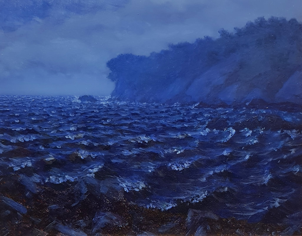
Wind and Tide Driven Waves
Oil on board 16” x 20”
On a gray rainy day, waves are driven into a narrow channel by the wind and incoming tide.
Oil on board 16” x 20”
On a gray rainy day, waves are driven into a narrow channel by the wind and incoming tide.
Vital Sign 3: Marine Birds
Marine Birds are predators near the top of marine nearshore food webs. Marine birds are long lived, conspicuous, abundant, widespread members of the marine ecosystem, and are sensitive to change... Many studies have documented that their behavior, diets, productivity, and survival changed when conditions changed. Public concern exists for the welfare of seabirds because they are affected by human activities, like oil pollution and commercial fishing. Dean, Bodkin, Coletti, Protocol Narrative NRR-2014/756
Marine birds were studied by groups traveling in skiffs, counting various species. The occasions I traveled with the scientists on these surveys provided a great chance to capture spectacular scenery, and I picked up information from listening to their observations. My time looking at the landscape in so many places added up to a greater understanding of my subject matter, the key to the success of the paintings in this exhibit.
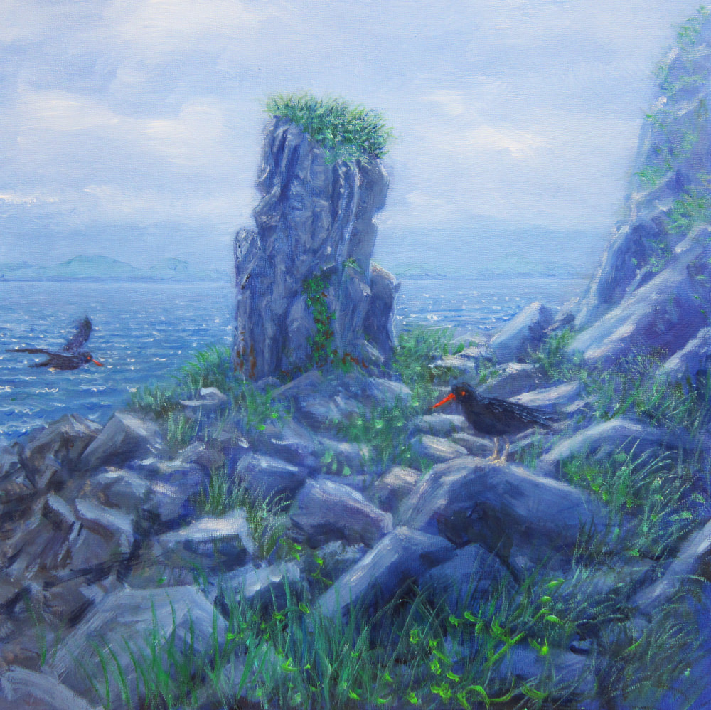
Vital Sign 4: Black OysterCatchers
Black Oystercatchers are well suited for inclusion into a long term monitoring program of nearshore habitats because they are long lived; reside and rely on intertidal habitats; consume a diet dominated by mussels, limpets, and chitons; and provision chicks from near nest sites for extended periods of time. Additionally, as a conspicuous species, sensitive to disturbances, the Black Oystercatcher would likely serve as a sentinel species in detecting change in nearshore communities resulting from human or other disturbances.
Dean, Bodkin, Coletti, Protocol Narrative NRR-2014/756
Black Oystercatchers were monitored through skiff- based surveys and walking surveys. Walking surveys were conducted along beaches at the same time as researchers looked for otter skulls and carcasses. Scientists searched for eggs and the Oystercatcher's very minimal nests. The remains of their prey found at nest sites were sampled, helping researchers understand what they were eating and feeding to their chicks.
The long walks along the beach were ideal for taking in scenery. The surveyed beaches were beautiful in their remoteness, and the surrounding landscape was spectacular. It was amazing to see how the Black Oystercatchers just dropped their eggs in the sand or gravel, slightly above the high tide line. It is hard to imagine how the eggs survive. It was very important to keep our eyes open when walking the beach, so we did not step on the eggs.
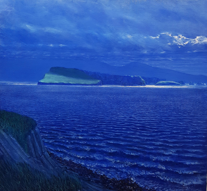
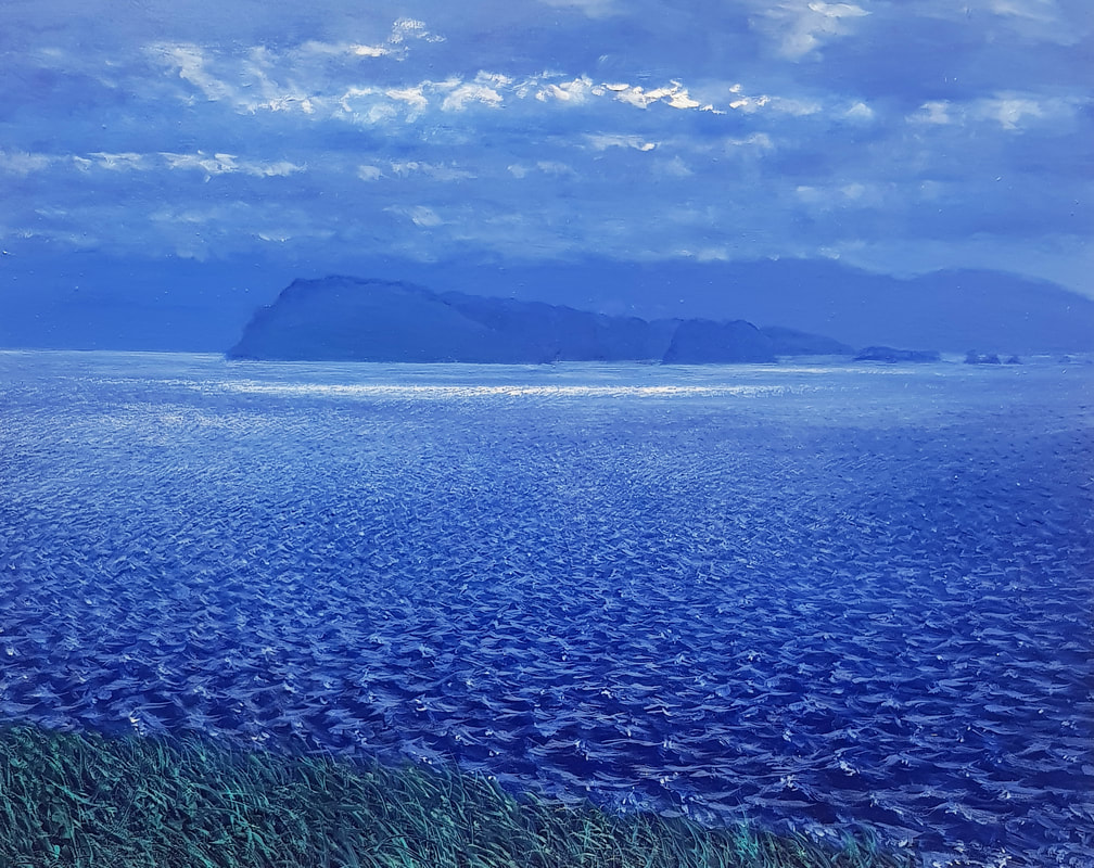
Emerald Isle
Oil on linen 28” x 30”
This prominent island could be seen from the small island in Amilak Bay where the researchers spent a lot of time watching otters. Some of the researchers referred to it as the Emerald Isle because it seemed appropriate, but I never got its real name.
Oil on linen 28” x 30”
This prominent island could be seen from the small island in Amilak Bay where the researchers spent a lot of time watching otters. Some of the researchers referred to it as the Emerald Isle because it seemed appropriate, but I never got its real name.
Emerald Isle in Gray
Oil on board 16” x 20”
The ever changing light, made for many studies of the Emerald Isle.
Oil on board 16” x 20”
The ever changing light, made for many studies of the Emerald Isle.

Light at the End of the World
Oil on linen 28” x 30”
The dramatic light, with broken cloud cover backlit by the sun, seems to dissolve these basalt islands at the mouth of Amalik Bay in light and reflection. With the vastness of the Gulf of Alaska looming in the distance, this scene had the feel of the land’s end.
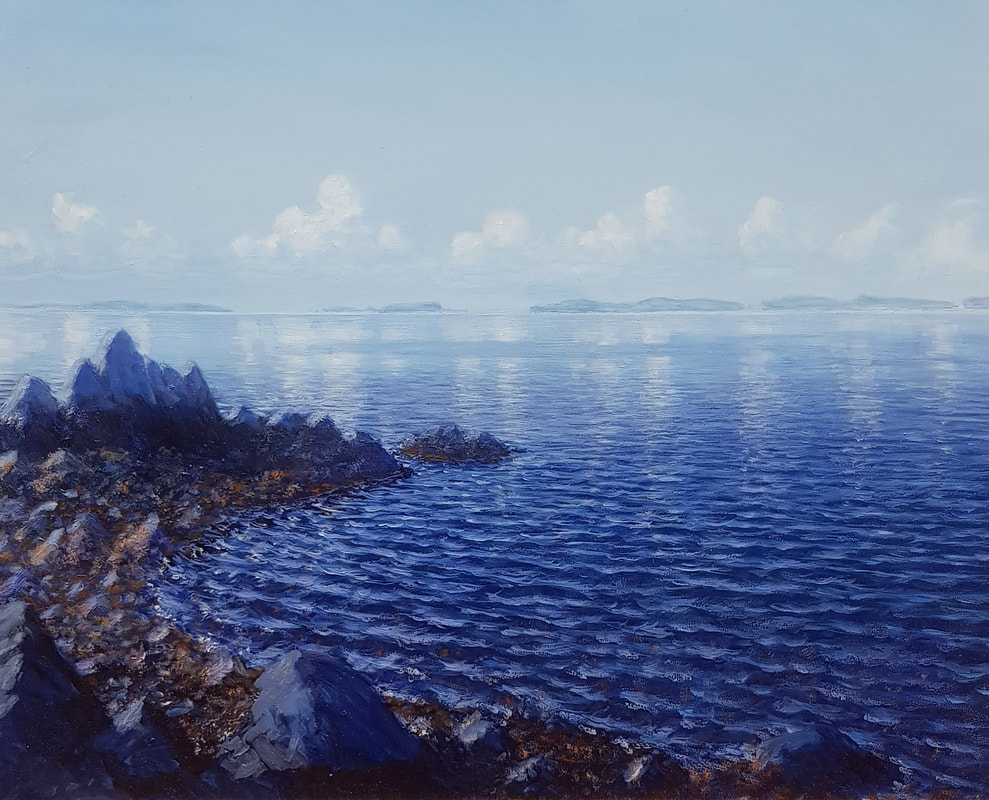
Islands and Clouds
Oil on board 16” x 20”
From a rocky shore on a calm day, the small islands of Amilak Bay and puffy cumulus clouds can be seen reflecting in the shimmering water.
Oil on board 16” x 20”
From a rocky shore on a calm day, the small islands of Amilak Bay and puffy cumulus clouds can be seen reflecting in the shimmering water.
Vital Sign 5: Sea Otters
Sea otters are a keystone species that can dramatically affect the structure and complexity of the nearshore ecological community. They cause well documented, top-down cascading effects on community structure by altering abundance of prey (e.g. sea urchins) which can in turn alter abundance of lower levels (e.g. kelps). Sea otters generally have smaller home ranges than other marine animals; eat large amounts of food; are susceptible to contaminants such as those related to oil spills; and have broad appeal to the public.
Dean, Bodkin, Coletti, Narrative Protocol NRR-2014/756
Because sea otters are such important animals in the nearshore ecosystem, they receive a lot of attention in the monitoring project. On numerous occasions, I was able to accompany scientists as they watched the otters with high-power spotting scopes. The long periods of observation gave me plenty of time to sketch the light and atmosphere for possible paintings, and to draw the details used in my finished pieces.
The scientists walk specific beaches searching for otter skulls. The teeth tell how old the otter was when it died, and the number of carcasses provides information on the age composition of the dying population. Walking the beaches provided another opportunity for me to view the scenery, and these activities were carried out regardless of weather. This was weather I normally would not have walked in, and gave me a new perspective. I ended up with a number of paintings that were very successful as well as unusual. And, after years of difficulty drawing in the rain, the scientists introduced me to a new kind of write-in-the-rain paper that has made it easy to draw in the rain ever since.
Vital Sign 6: Marine Water Chemistry & Water Quality
Marine water chemistry and water quality, including temperatures and salinity, are critical to intertidal fauna and flora are likely to be determinants of both long-term and short-term fluctuations in the intertidal biotic community. Basic water chemistry parameters provide record of environmental conditions at the time of sampling, and are used in assessing the condition of biological assemblages. Water quality (including water temperatures, salinity, and levels of contaminants such as heavy metals and organic pollutants) are also critical in structuring nearshore marine ecosystems, and can cause both acute and chronic changes in nearshore populations and communities. Dean, Bodkin, Coletti, Narrative Protocol NRR-2014/756
Mussels, being filter feeders, concentrate contaminants, so the scientists sampled mussel tissue. Various levels in mussel tissue can be used to assess levels in the water. Although monitoring this vital sign had little to do with my work as an artist, it was an important part of the reason we were out there by the Katmai Shore.
Credits
The nearshore component of the Gulf Watch Alaska Monitoring Program is funded by the Exxon Valdez Oil Spill Trustees Council (EVOSTC), the National Park Service Southwest Alaska Network Inventory and Monitoring Program (SWAN), the US Geological Survey and NOAA.
Dean, T.A.,J.L. Bodkin, H.A. Coletti, 2014. Protocol Narrative for Marine Nearshore Ecosystem Monitoring in the Gulf of Alaska: Version 1.1 Natural Resource Report NPS/ SWAN//NRR-2014/756. National Park Service, Fort Collins, Colorado.
Heather Coletti,Marine Ecologist, NPS
James Bodkin,Marine Ecologist, USGS Emeritus
Brenda Ballachey, Research Physiologist,USGS Emeritus
Elizabeth Bowen, Ecologist, USGS
Dan Esler, Marine Ecologist, USGS
Benjamin Weitzman,Marine Ecologist, USGS
John Paszalek,Bio Tech, USGS
Yosty Storms, Bio Tech, USGS
Bob Peterson, Bio Tech, NPS
Taj Shoemaker, Pilot
Andy Schroeder, Boat Captain
Je Carr, Deck Hand
Bradley Ewing, Cook
Beach and Basalt in the Sun
Oil on linen 28” x 30”
This sunny beach on an island in Amalik Bay looked tropical and inviting.
Oil on linen 28” x 30”
This sunny beach on an island in Amalik Bay looked tropical and inviting.
Beach in the Sun
Oil on linen 28" x 30"
A small island with a rocky beach washed by waves and sun.
Oil on linen 28" x 30"
A small island with a rocky beach washed by waves and sun.
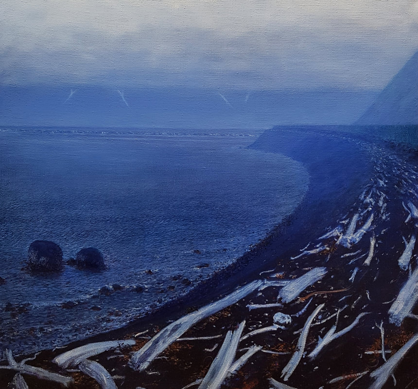
Beach in the Rain and Mist Oil on linen 28" x 30"At near low tide, protected by a steep sided island, this beach stretches off into the mist. Strewn with driftwood and seaweed, it was a good beach to look for otter skulls and Black Oyster Catcher eggs.
Light Beyond the Mountains
Oil on board 16” x 20”
At near sunrise, a beautiful display of color silhouettes the mountains to the northeast.
Oil on board 16” x 20”
At near sunrise, a beautiful display of color silhouettes the mountains to the northeast.
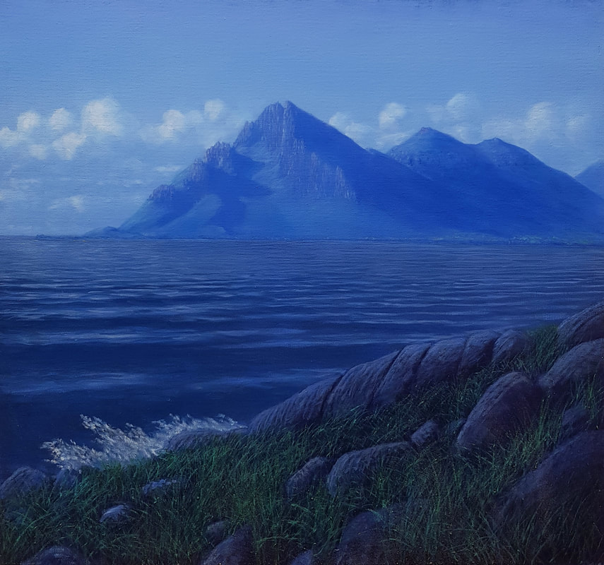
Mountain and Clouds in the Sun Oil on linen 28” x 30”
From a small island, this mountain can be seen jutting into the Gulf of Alaska, forming the southwestern side of the bay. Gentle swells can be seen rolling in, and the brilliant sun makes the mountain and clouds seem ethereal.
From a small island, this mountain can be seen jutting into the Gulf of Alaska, forming the southwestern side of the bay. Gentle swells can be seen rolling in, and the brilliant sun makes the mountain and clouds seem ethereal.
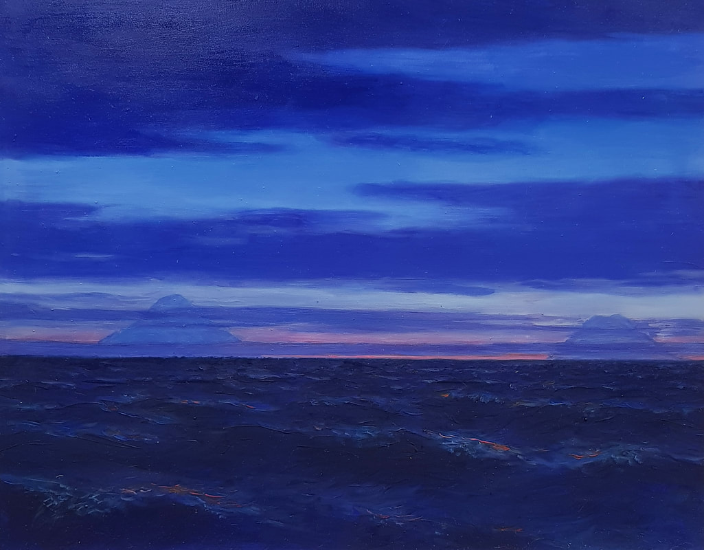
Volcanoes and Waves
Oil on board 16” x 20”
On the way back to Homer, Redoubt and Illiamna are visible at sunset.
Oil on board 16” x 20”
On the way back to Homer, Redoubt and Illiamna are visible at sunset.
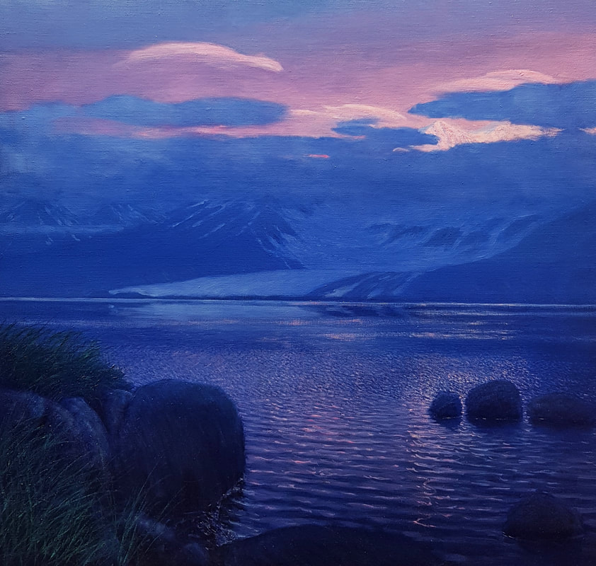
Sunrise Light over Mountains and Glacier
Oil on linen 28” x 30”
At Sunrise, High Clouds and Mountains catch the light above the blue of a tranquil morning.
Oil on linen 28” x 30”
At Sunrise, High Clouds and Mountains catch the light above the blue of a tranquil morning.
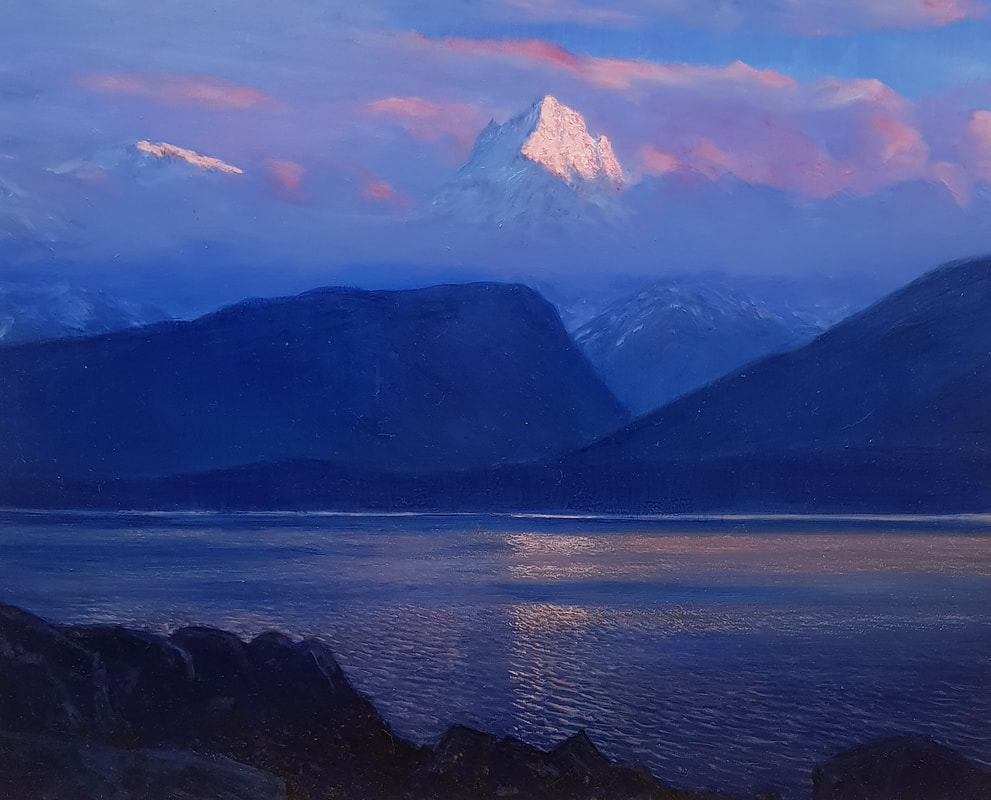
Mountain in Sunrise Light
oil on board 16” x 20”
A tower of rock and ice is illuminated by the rising sun.
oil on board 16” x 20”
A tower of rock and ice is illuminated by the rising sun.
Artist Statement:
I am a realist landscape painter. I create my paintings in my studio using drawings done in the field, as well as memory and experience. The resulting images are more real than photographs, because they represent what I actually see and experience, without the influence of photographic effects. My vision is valuable, not because I am an artist gifted with a talent, but because I have spent forty years studying landscapes. I see more in nature than a casual viewer, and in my work I can reveal the hidden beauty in nature.
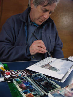
Working Methods:
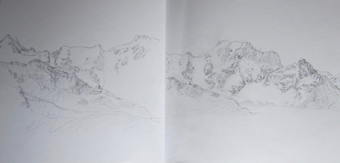
To create my paintings, I use simple tools. The most important of which are the sketch books and the drawings contained in them. I draw in the field, and my drawings, along with memory and experience, are the source for all the information needed to create the watercolor studies and oil paintings. During my time out at Katmai I mostly filled two sketchbooks with hundreds of drawings. I then began painting watercolors on the boat and finished some watercolors at home after the trip. I ended up with over sixty of the small watercolor studies, some of which are seen in the exhibit and this catalogue. I then painted about twenty small oil studies, which I used as a guide to select ten scenes to be painted as full size oils.
I use traditional oil painting techniques in my work, I start with an underpainting, a somewhat fuzzy image painted with thick paint that establishes the lights and darks. I then layer on as many as ten layers of paint with each layer becoming thinner and containing more detail until the last layers are made of very transparent glazes. The process gives the paintings very complex colors and helps to give them a sense of depth, as well as atmosphere and light.
 RSS Feed